

What do you get when you put a reservoir right on a state line, fill it with striped bass, and surround it with 89,000 acres of open water? Lake Texoma, one of the largest reservoirs in the United States, and a lake with a personality as split as its shoreline. Half of it behaves like Texas. Half of it behaves like Oklahoma. And the water in the middle has been the subject of a legal fight that reached the Supreme Court.
This guide covers what the lake actually is, how it got here, what people do on it, and the practical details that trip up first-time visitors.
Where Lake Texoma Sits and How Big It Really Is
Lake Texoma straddles the Texas-Oklahoma border on the Red River, roughly 70 miles north of Dallas-Fort Worth. That location is why the lake exists in the first place: it sits close enough to a major metro area to serve as a weekend escape, but far enough out that the shoreline still feels rural in long stretches.
The surface area is usually cited at about 89,000 acres at normal pool, which puts it among the largest reservoirs in the country by surface area. That figure gets repeated everywhere, and it is broadly right, but treat it as a rough number rather than gospel. Acreage, storage capacity, and pool elevation shift with sedimentation and with how the dam is being operated. If you need an authoritative figure for planning or research, the U.S. Army Corps of Engineers water-management data is the place to look, not a tourism brochure.
The lake is operated by the U.S. Army Corps of Engineers, Tulsa District, which manages the reservoir, the dam, and the recreation areas around it.
How Denison Dam Created the Lake
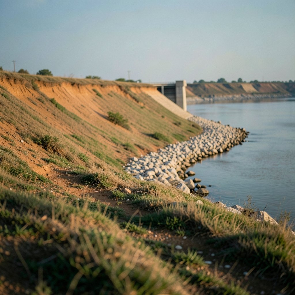
Lake Texoma is not a natural lake. It exists because of Denison Dam, a rolled-earthfill structure built across the Red River. Construction began in 1939 and the dam was completed in 1944. The project had been authorized earlier by the Flood Control Act of 1938.
The authorized purposes tell you a lot about why the lake looks the way it does:
| Purpose | What it means in practice |
|---|---|
| Flood control | The reservoir holds back Red River floods downstream |
| Hydroelectric power | A powerhouse at the dam generates electricity |
| Water supply | Communities in both states draw from the lake |
| Recreation | Boating, fishing, camping, and shoreline access |
The name itself is a portmanteau of Texas and Oklahoma, coined around the time the project was being planned in the late 1930s and early 1940s. It is a neat bit of branding that has aged well.
The State Line Problem
Here is where Lake Texoma gets genuinely interesting. The Texas-Oklahoma state line runs through the lake, and the two states have argued for decades about exactly where that boundary falls in the lakebed and who controls the water.
That dispute was not a historical curiosity. It produced a U.S. Supreme Court case, Oklahoma v. Texas, decided in 2023. The practical upshot for visitors is simple: you may cross a state line without noticing, and the rules that apply to you, from fishing licenses to boating regulations, can change depending on which side of an invisible line you are floating on.
This is one of the most common mistakes people make at Texoma. They buy a Texas license, drift north, and assume it still covers them. It may not. Check the rules for both states before you launch, especially if you plan to fish near the main body of the lake rather than tucked into a creek arm.
Fishing: Why Texoma Has a Reputation
Lake Texoma is best known for striped bass. The lake has a long history as a striper fishery and has hosted major bass-fishing tournaments over the years. The combination of open water, baitfish, and deep channels gives striped bass what they need to grow large, and anglers travel from across the region for a shot at them.
Beyond stripers, the lake supports a mixed fishery that includes largemouth and smallmouth bass, catfish, and crappie. Structure matters here. The lake has plenty of creek arms, points, and submerged cover, and the fishing changes dramatically between the main lake and the upper river sections.
A few practical notes that experienced anglers at Texoma tend to repeat:
- Match your license to your location. Confirm which state’s waters you are in and buy accordingly. Do not assume reciprocity.
- Watch the wind. A reservoir this large with this much open water builds chop fast. A calm morning can turn into a rough afternoon.
- Fish the transitions. Creek mouths and points where depth changes are more reliable than random open water.
- Check current lake levels before you go. Water level affects ramps, shoreline access, and where fish hold.
Boating, Camping, and Shoreline Recreation
The recreation side of Lake Texoma is substantial. The Corps of Engineers manages numerous recreation areas around the shoreline, and there are marinas, campgrounds, and day-use areas on both the Texas and Oklahoma sides.
Boating is the dominant activity. The lake is big enough for sailing, powerboating, and long runs up the river arms, and there are enough ramps and marinas that most visitors can find a launch point without much trouble. Camping ranges from developed campgrounds with hookups to more primitive sites.
The shoreline itself is varied. Some stretches are rocky and steep, others flatten into sandy or muddy banks. If you are picking a spot for the day, the difference matters more than it sounds: a steep rocky bank is great for fishing access and terrible for small children.
Water Supply and the Dallas Connection
Lake Texoma is a working reservoir that also serves as a playground. It supplies water to communities in both states. The North Texas Municipal Water District has pursued Texoma water for the Dallas region, and water supply has been one of the lake’s authorized purposes since the beginning. (The row)
This creates the central tension of Texoma: it is simultaneously a flood-control structure, a power source, a municipal water source, and a recreation destination. Those uses do not always pull in the same direction, and the state-line dispute is partly a symptom of that. When a lake is this valuable, everyone wants a clear claim on it.
Flooding History and Why Water Levels Matter
Lake Texoma has seen major flood events, with 1990 and 2015 commonly cited as significant high-water years that closed recreation areas and damaged infrastructure. Anyone who has watched a reservoir operate knows the pattern: drought years draw the shoreline out, flood years push it back and shut down ramps and campgrounds.
For visitors, this means checking conditions is not optional. A lake that is 89,000 acres at normal pool can look very different after a wet spring or a dry summer. Ramp usability, beach access, and even which recreation areas are open all depend on the current pool.
Common Mistakes Visitors Make
A few things trip people up repeatedly at Texoma, and none of them are obvious until they cause a problem.
Assuming one license covers both states. It usually does not. The state line runs through the lake.
Underestimating the wind. Big open water plus afternoon gusts equals uncomfortable and sometimes dangerous boating. Plan around the forecast.
Skipping the level check. Showing up to a ramp that is out of the water is a bad start to a weekend.
Treating the lake as a single place. Texoma has distinct zones: the main body, the river arms, and the transition areas. Fishing, boating, and swimming all behave differently depending on where you are.
Forgetting the shoreline is public land with rules. Corps-managed areas have their own regulations. Read the signage.
What Makes Texoma Different From Other Reservoirs
Plenty of reservoirs are big. Plenty are good for fishing. Texoma’s distinguishing feature is the combination of scale, a two-state jurisdiction, and a genuine legal history over the boundary.
That two-state split is also why the lake attracts a mix of visitors that is unusual for a reservoir of its size. Texas-side marinas and Oklahoma-side marinas serve overlapping crowds, and the culture around the lake reflects both. If you spend a weekend there, you will likely cross the line more than once without thinking about it.
The lake also sits in a part of the country where hair and humidity are a running conversation, which is why you will see everything from sleek 2b hair to full 4c hair on the boat ramps and beaches on a summer afternoon. Lake life is not fussy, and Texoma is not a fussy lake.
Planning a Trip: A Simple Approach
If you are putting together a first visit, work through it in order.
- Pick your side. Decide whether you are basing on the Texas or Oklahoma side. It affects your drive, your license, and your ramp options.
- Check the current lake level and conditions. Use official water-management data rather than a random app.
- Confirm your license requirements for the waters you actually plan to fish.
- Reserve early in summer. Campgrounds and marinas fill up.
- Build in a wind backup plan. Have a shoreline activity ready for the afternoon chop.
For anyone used to a tighter, more contained lake, the scale takes adjustment. Texoma rewards people who plan in zones rather than trying to “do the whole lake” in a weekend.
Conclusion
Lake Texoma is a reservoir with a split identity and a real legal history, and that is exactly what makes it worth understanding before you visit. Created by Denison Dam in 1944, authorized by the Flood Control Act of 1938, and named for the two states it divides, it functions as flood control, power source, water supply, and recreation destination all at once. It is also one of the largest reservoirs in the country by surface area, which means the experience changes depending on where you launch.
The practical takeaway is straightforward. Check the water level. Confirm which state’s rules apply to you. Respect the wind. And do not assume the line in the middle of the lake is just a formality. Texoma rewards visitors who treat it as the complicated, two-state, working reservoir it actually is.
FAQ
Is Lake Texoma in Texas or Oklahoma?
Both. The lake straddles the Texas-Oklahoma border on the Red River, and the state line runs through the water. That is why the name combines the two states and why jurisdiction questions have been litigated for decades.
When was Lake Texoma built?
Denison Dam was completed in 1944, with construction starting in 1939. The project was authorized by the Flood Control Act of 1938.
How big is Lake Texoma?
It is commonly cited at roughly 89,000 acres at normal pool, making it one of the largest reservoirs in the United States by surface area. Exact figures vary by source and year, so check current water-management data for authoritative numbers.
Do I need a fishing license for both states?
Possibly, depending on where you fish. Because the state line crosses the lake, the license requirement can change with your location. Confirm the rules for the specific waters you plan to fish before you go.
What is Lake Texoma known for?
Striped bass fishing is the headline attraction, along with boating, camping, and shoreline recreation. It is also known for its size, its two-state jurisdiction, and the long-running boundary dispute that reached the Supreme Court in Oklahoma v. Texas.
Has Lake Texoma ever flooded?
Yes. Major high-water events are commonly cited in 1990 and 2015, when flooding closed recreation areas and damaged infrastructure. Water levels vary significantly year to year, which is why checking conditions before a trip matters.